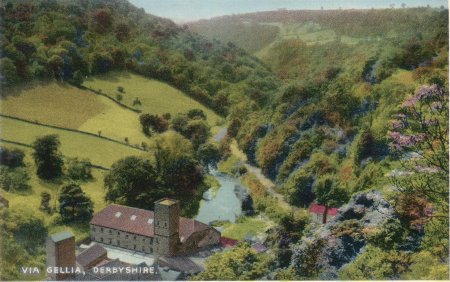
Unposted, similar card posted 1957

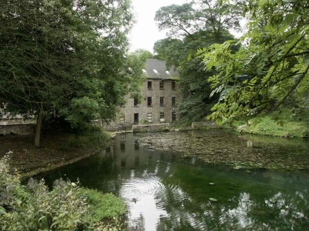
Taken Aug 2006 by Keith Repton. A view of Via Gellia Mills
from the feeder pond

Via Gellia mills.
The modern Viyella label takes its name from the Via Gellia Mills in
Derbyshire, bought by then-owner Henry Hollins in the 1890s. The local
nickname of the Valley Vi Jella became Viyella the first ever branded
fabric to be registered.
Keith Repton writes:
Hi John,
The building in the photo is, as far as I can see, the Via
Gellia mills, the small red roofed building just to the right is the
Pig of Lead public house at the bottom of Clatterway.
Since 2004 the old mill has been partly occupied by
The Play Mill, together with
another 25 traders.
The Lake is a mill pond serving the mill. In the distance is Slinter Wood.
The Arkwright Society has
a "Slinter Project". They say:
"Welcome to the Slinter Project
The Slinter Project is responsible for the management of the Slinter Wood
Estate and the recently acquired Dunsley Meadows.
This forms a strip of 51 acres of land, about a mile long, on the south
side of Bonsall Valley, from the Cromford corn mill to just beyond the
Via Gellia Mills.
The bottom of this valley is defined by a series of six mill ponds,
much of it forming an attractive wet-land habitat.
The valley sides rise about 250ft to form a wooded limestone escarpment.
The Dunsley Meadows are a small group of traditionally grazed fields on the
west side between the woods and the valley bottom."
The Arkwright Society
Dates:
Photo taken:
Size:postcard
Source:

Click on photo for enlargement (on CD only)
Have any more information about this photo?
Please e-mail the author on:

Hi John,
The building in the photo is, as far as I can see, the Via Gellia mills, the small red roofed building just to the right is the Pig of Lead public house at the bottom of Clatterway.
The Slinter Project is responsible for the management of the Slinter Wood Estate and the recently acquired Dunsley Meadows.
This forms a strip of 51 acres of land, about a mile long, on the south side of Bonsall Valley, from the Cromford corn mill to just beyond the Via Gellia Mills.
The bottom of this valley is defined by a series of six mill ponds, much of it forming an attractive wet-land habitat. The valley sides rise about 250ft to form a wooded limestone escarpment.
The Dunsley Meadows are a small group of traditionally grazed fields on the west side between the woods and the valley bottom."
The Arkwright Society
Dates: Photo taken: Size:postcard Source:Click on photo for enlargement (on CD only) Have any more information about this photo? Please e-mail the author on:
