My contributor says "The road parallel to the top of the picture is Bent Lane/Cavendish Road, the road at the bottom of the picture is Smedley St, road mid bottom to top right is Wellington St, road bottom right to top right is Dob Lane/Bank Road. The direction of view is due north, the white building almost centre is the Thorntree Pub (in Jackson Road). This was the most developed area of the Bank, There were no houses on Bank Road or Woolley Road, Cavendish Park is all farmland. Smedleys Hydro IS gone but its predecessor is in place on the corner of Smedley St/Old Hackney Lane and Bank Road/Dob lane. Smedley was to buy this building in 1853 and it was enlarged shortly afterwards.
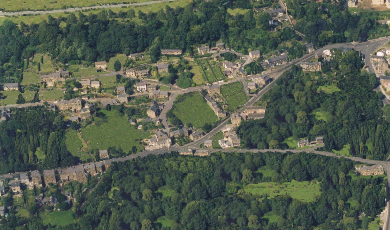 All Saints Church is removed while a modern extension to Jackson Tor House is left in place as it is on the site of long demolished buildings. Cobden Terrace makes a comeback between Cobden Road and Jackson Tor Road. According to the 1841 Census the greatest employment was Agricultural labourer, Framework Knitter and Cotton/Bleach mill worker. There was a huge expansion soon to come when the Hydros started up. In this photo alone 4 will be built in the next 30 years. Smedleys, Rockside, Jackson Tor House and a smaller one on Wellington St. All provided valuable employment when Mills like Smedleys ruined the Framework Knitters trade leading to riots, starvation and mass emigration - particularly around Nottingham."